The caldera rim consists of deeply eroded hills and cliffs. The large island in Taal Lake is known as Volcano Island It also contains a crater lake. The bright yellow patch on the southwest side of the island marks the site of an explosion crater that formed during a deadly eruption of Taal in 1965 (see photos below). The image was acquired by the Spaceborne Imaging Radar-C/X-band Synthetic Aperture Radar (SIR-C/X-SAR) aboard the space shuttle Endeavour on October 5, 1994. The image shows an area approximately 56 kilometers by 112 kilometers (34 miles by 68 miles). North is toward the upper right of the image. Source of image: SIR-C/X-SAR Space radar images of Earth at Jet Propulsion Laboratory. P-44903 November 18, 1994 |
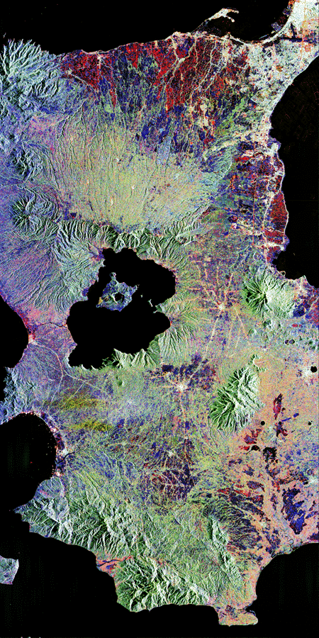
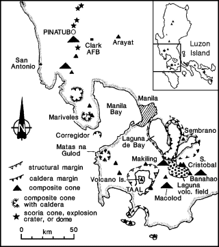
Taal, Lake, lake in the Philippines on the island of Luzon, occupying the crater of an extinct volcano, about 56 km (about 35 mi) south of Manila. The third largest lake in the Philippines, it covers an area of 240 sq km (94 sq mi). Lake Taal is drained by the Pansipit River. Volcano Island lies in Lake Taal; on Volcano Island is another volcano called Taal Volcano. |
Taal Volcano (3) |
Please wait, while big SpaceImagePhoto and other pictures from Taal are loading.....
Malapascua Island

Visayan Sea, Cebu, Philippines,